Tuesday, September 13, 2011

The headnet as a multi-use item

A great way to go lighter is to find items that can perform several roles, allowing you to reduce the number of items in your pack. The classic cotton bandana is probably the ultimate example, protecting you from the glaring sun, prefiltering your water, drying your body after a swim, protecting your hands from glowing pot handles etc.


This summer I've discovered another contender, the headnet. Apart from keeping the mosquito hordes at bay, it is a great pillow (the mesh is surprisingly comfortable next to the skin) when stuffed with your puffy layer. It is also a very good prefilter, much better than the bandana, and a very functional stuff sack. Some of you may be worried about the durability, but it is better than expected when made out of high quality noseeum mesh.

Pillow mode with my Montbell Down Inner stuffed inside.


Prefilter.
Clothes bag.
I made mine according to the plans that can be found on www.andersj.se, and using noseeum from my thru-hiker down quilt kit (yes, I'm cannibalizing that bad boy). It only took me 1-2 hours. It's a great project that I know you will enjoy and the result is oh so functional and weight saving.

Very light and packable. Only 11 grams including the blue rubber band which is a multi-use item too!


Please feel free to leave comments about other multi-use items that you know about. I am very interested in discovering more, and I am confident I am not the only one

Thursday, August 25, 2011

And the winner is

According to random.org: Helen J. Fisher!. She has an abundance of good karma stored at the moment :). Congrats.

Saturday, August 13, 2011

Raffle time: aLOKSAK set


It's time for another raffle! This time it's for a set of four aLOKSAK waterproof/sandproof bags/pouches that are excellent for storing and protecting important items like your passport, first aid kit, electronic devices etc. The sizes are : 5"x4", 4.5"x7", 6.75"x6" and 9"x6".

To be part of the raffle I ask you to share an important lesson you learned while out hiking, or a practical tip that other readers might find useful.

I'll draw a winner with random.org the 25th this month. Good luck!


Sunday, August 7, 2011

Jotunheimstien - the second week part 2

Joe looking at the mighty mountain ranges in the distance.


The 14th of July, after a nice, comfortable stay in the DNT cabin "Skjelbreidhytta" we set off once again. 10 metres from the hut we entered a steep climb that took us above treeline. We both felt strong at this point and had no trouble doing the climb without stopping to catch our breath. I voiced this to Joe and he agreed completely, we we're both definitely more fit than we started the trail back in downtown Oslo.

The trail was very nice, at times almost qualifying as "super trail", but not quite getting that accolade because of stones at places that threatened to trip us over, and a pack of sheep that just didn't get that it would be sensible to go left or right instead of being pushed directly ahead by us for several kilometres. One of the lambs was apparently brighter than the mum and her sibling, and at times tried to venture out to the side, but the mum just didn't get it. After a while Joe got the bright idea to charge them which made them panic and finally run to the side so we could pass them. Note that it was a light charge :). We both love animals so we didn't want to scare them too much in the process.

While on this stretch of trail we passed a peak which was supposed to have nice views of some 60 peaks, and even a sighting board of sorts with the names of each. We both wanted to take a look at that, eager to see more of the mountain ranges ahead, so we hid our packs behind a tree, registered a GPS waypoint (very wise suggestion by Mr. Newton) and climbed upwards, aided by our trekking poles. We did indeed get some fine views, but no sighting board was to be found, so we were probably not where we were supposed to be after all. I was glad I'd included my binoculars in the resupply box. We swapped them between us frequently so we could both get glimpses of the peaks we were soon going to be seeing up close. The GPS waypoint "Sekkene" was real helpful on our way down since I could follow the arrow on my GPS compass all the way down to within 3 metres. Quite impressive. We would've found them without the GPS, but it was a lot quicker that way.

Maybe half way to Kittilbua, while we were taking a short break, Joe told me he was feeling a pain in his shin. He massaged and stretched it as best he could and walked around putting weight on it to try to diagnose the severity of the problem. I suggested that we should reduce the pace and take our time not to worsen it.

We continued on in sunshine and on nice trails, across fields and bog (the drier kind) and through clusters of trees close to the treeline. I had read that we would be able to buy waffles with brunost and rømmegrøt and all that good stuff at Kittilbua, and that motivated us in big way, especially Joe which loves that stuff more than any foreigner I've met. That last stretch seemed to take forever as our mouths watered.


Suddenly Joe stopped, apparently in great pain. "I think this is it for me", "Sorry?" I said. "Yes, this is probably the end of the trail for me". He took off his pack and sat down, rubbing his shin and looking worried. This didn't look good at all. We were both silent and feeling sad as I led us slowly along the last bit of trail before we reached Kittilbua.

To our surprise Kittilbua wasn't staffed and there were no waffles or stuff like that to be found. It was actually just a regular DNT hut that was closed, needing one of those DNT keys which we both carried (Helen: remember). A table with benches was close by and we sat down there to have lunch, discussing the situation. It looked grim indeed. I suggested we stay the night at the hut to see if it might improve, but at the same time I advised him not to continue if his shin wasn't a lot better the next day. I didn't think he should risk the rest of the hiking season or year for that matter just to complete this trail. He could always return to complete it. In a way we were lucky to have this happen close to a DNT hut and to a road, so that he could be picked up by friends and family instead of a search and rescue chopper. Joe called his friend to let her know about the situation and to be prepared to come pick him up the following day. While he was doing that I realized that the waffles etc. was available at the wilderness museum 500m away, so I went over there to shop and to ask where we were in relation to public transport etc.

The wilderness museum was as devoid of humans as the very thing it was constructed to present, so the woman and her companion looked startled to have somebody walk in the door. Pancakes, Solo (the best soda available in Norway) and some candy was quickly bought and I asked her about transportation for Joe. Apparently we were an hour or so from Vestre Gausdal and no buses or other means of transport were available. She did however offer Joe a ride in her old, colorful car down to Vestre Gausdal. I thanked her and said I would let him know.

When I returned Joe was massaging his shin, not feeling better. We moved our stuff into the cabin and I proceeded to collect water in the river and heat some water for washing and dinner.

Joe having his mac n' cheese, his favourite.
The hut was nice and we both enjoyed staying there, even more so when we were joined by a biker guy who'd just come in from Rondane, having hiked there for three days. He had some ointment for Joe to try, but that didn't help much. The beers he offered us helped more :). We spent the evening talking to him and listening to the crackle from the wood oven placed in the middle of the room.

The next morning Joe felt a bit better, but it didn't take long before he told me it was as bad as yesterday. I finished packing and got ready to move on. I considered quitting the trail too, but I felt a strong urge to complete it, having planned for it so long and done so much of the trail already. Since Joe was going to get picked up by his friends I didn't feel too bad about leaving him there. If I'd quit too I would had to return to Oslo alone and what was the point in that?. Before leaving we took some pictures, I said my goodbyes, gave Joe a hug and started my day on the trail.

Last photo before I left Joe to wait for his friends to pick him up. That checked Rohan shirt of his is way cool btw :).


First order of business was to get the morning backtrack out of the way. I followed a short piece of trail onto the main road and then went too far, not seeing the trail markings. This time I couldn't blame the gear talk :). Before moving any further I stopped to take a look at my map and GPS to make sure I was 100% sure of my position. This is something I've started to do after reading about Yogi and her tendency to do so. I think it is a wise habit. I soon figured out where I was and continued along on a forest road herding 20 cows in front of me, a nice change from sheep, and then followed the familiar red markings through forest and bog (the not too bad kind).


Not too bad this bog.


Having lunch with my bug friends who were joined by the red biting ants, my favourite.


From the map I saw that I was to climb a hill, but I didn't realize I was at the top before I reached a 5-6m sighting tower which I of course had to climb to get some views. The views were stunning.


My goal for the day was to get to the staffed hut, Liomseter, something that would turn out to be a long walk. If I were to do it again I wouldn't push for Liomseter, and instead camp a bit more than halfway. Having set a goal I was determind to reach it though and kept at it. My tweet from the next day sums it up :

"Long day yesterday, 32 km in various terrain, bog, hills, valleys, rivers, rivendell like forest, amazing views. Arrived late at the staffed hut Liomseter where i had dinner, beer, shower and a nice chat with some guys who were very curious about the trip and lightweight backpacking".


It was nice to be higher up with less bugs, a nice cooling breeze and some spectacular views. A rainstorm to the west was looking a bit threatening, but it didn't turn out to be a problem.


This well was right beside the trail and offered splendid water. I was careful not to contaminate it and used my pot to scoop with.


This was a beautiful place. The camera just isn't able to capture it.


I was getting pretty tired by the end of the day, especially after a long boggy section. Suddenly the trail markings disappeared and I couldn't see where I was supposed to cross the river to the left of me. I spread out my map on the ground and touched the screen of my GPS to wake it up, and then tried to figure things out before moving on. A couple of particularly eager swarms of mosquitoes and noseeums took an interest in me, almost making it impossible to study the map. I decided to go back and then when I was just about to move I saw red trail markings going upwards, in the opposite direction? This puzzled me. I decided to follow them to see if it could be some eccentric trail design. The trail went upwards a bit, and then turned to the right in the direction I had come. What is this?. I moved a bit in that direction and then suddenly it dawned on me that I was supposed to have followed this path from the get go. I had been lured by signs of people moving through the grass to the left of it and thought that to be just a poorly marked piece of the trail. I turned around, backtracked and found the trail again which led to the river crossing. Stupid in retrospect, but it's easy to get confused like this, especially when tired at the end of a long day hiking.

It was getting late now, and looking at the map I thought I would be lucky to get to the hut before they turned of the generator at 11 PM. I hiked over a hill and expected to be forced to hike over yet another one, when I realized that my two maps overlapped quite a bit, so I was actually only 4.5 km as the crow flies from my destination. Hoorah!. I powered on and was soon at Liomseter where there was a band of clarinet players giving a concert to the dinner guests. I talked to the nice hostess and she told me I could have dinner even though I was half an hour late. I was really happy with that, not having expected to get anything being that late. I just had to wait for the band to finish their perfomance. That gave me time to shower, wash clothes and sort everything out. What an excellent hut! Dinner was great and I had a nice conversation with a couple of guys who were very interested in hearing about our adventure and about lightweight gear.

I felt very refreshed the next day, and that morning's backtrack was only half a kilometre, not bad at all. Having located the begnning of the trail towards Storkvelvbu, I climbed higher, moving through the forest and breaking treeline to enter a nice trail which allowed for fast hiking. When I started out at the hut there was a light drizzle and a light breeze. That changed after a while though with the wind picking up, rain pounding my back and temperature dropping to a measly 7C. I was getting cold, so I stopped to don my woolpower long johns and my rain pants, as well as my MLD event rain mitts with gloves inside. That helped a lot and it didn't take too long before I arrived at Storkvelvbu, which I initially had planned to bypass, but since the weather was so poor I decided to stop and have lunch there. A group of youths were there already and was about to leave. I said hello and asked if they were from the DNT youth association or something, but no they were just a group of friends who had decided to go hiking. While they prepared to leave I put the kettle on and started to prepare lunch. The hut guard/host arrived after a while and we had a nice chat. He was a bit surprised to hear that I, and the youths that has just left, were continuing on to Storhøliseter. Must people tended to stay at Storkvelvbu he told me. After a while he left me to finish my lunch, and retreated to his own hut close to the main hut where he told me he had the wood oven going and his dog lounging beside it at the moment :).

It wasn't exactly pleasant to leave the hut to hike on in that weather, but I wanted to reach the goal I had set for the day. The visibility was very poor and it was now just a matter of getting to the next hut. I was quite chilled when I got there and very thankful not having to spend the night under my Trailstar!

Cold. Wet, windy, cold temps will do that too you.
Instead I got to spend the night in my own room, to eat dinner with the youths and to talk to a couple of german guys who had a lot to tell about their trip in Norway.

Only two days remained now before I could finish my thru-hike! Since the youths had done the dishes the previous evening, and apparently were stressed out about getting going, I offered to sweep the floor etc. after them, something I don't think they realized they had to do. I told them I would try to catch up, which I had tried to do the day before just to have a goal to work towards, but without success. Cleaning up after them was a bad deal and it took me 45 minutes of sweeping and packing before I could get on the trail myself. I knew it would be a long day with a 500m climb and descent at the end, but I felt great and hiked on at a mile crunching pace.


I must have gained a lot on the youths because when I passed the Oskampen hut, I saw their packs outside and them having lunch inside, but I decided to move on to have some privacy when having lunch. I pitched my Trailstar to get out of the wind and drizzle. The Trailstar is great for this purpose!. I then hiked on and reached the point where I was to start climbing the last mountain to get to Sikkildalsseter, the staffed hut which was my destination for the day.


Before the climb I decided to fill my water bottles, not expecting to find any water on the mountain. Suddenly a røyskatt popped his head up and looked curiously at me! :). What a beautiful animal. His companion also appeared and they moved swiftly among the rocks, disappearing and appearing again. My camera battery was of course flat, so I couldn't document this. I wanted to give them something, so I brought forth a babybel cheese and waited to see if they would approach to eat it. They tried their best to approach via the small passages between the rocks, but they were never sure enough of their safety to take a bite. I decided to move 5-10 metres away, and then one of them appeared in the spot I had been sitting, scouted around for me in all directions, and proceeded to eat that delicious piece of cheese :).

The climb up the mountain was quite tiring and I had to stop several times to catch my breath, but the views were spectacular at every rest stop!.


Suddenly, at 1350 metres, I saw a small group of reindeer ahead of me, maybe 75-100 metres away. The wind was blowing in the direction I was moving so they had no doubt smelled me. I stopped in my tracks and watched them a long time (I loved my binoculars at that point!), before they in their smooth, flowing way of moving moved on up to the right and disappeared over a ridge. I saw 3-4 more groups before suddenly seeing a large pack 50+ animals. Wonderful. I spent quite some time just watching them.


Three reindeer running to join the pack. Too bad I didn't get to photograph them on the ridge with that sky as the backdrop.


The big pack. Hard to see because their camouflage is so effective. Click to zoom.


I soon got to the top of the mountain and saw the sign telling me that I was now at 1525 metres, the highest point along the Jotunheimstien trail.


This looked 10 times better in real life, believe me.
I just had to descend 500 metres now to get to Sikkildalsseter. The views were once again beautiful and I cried "Woooohooo!" as hard as I could muster in pure excitement and joy of life.

The hut, or hotel is a better description, had only two other guests, so getting a single room was very possible indeed. I even got dinner and I enjoyed that immensely, only wishing my trail buddy Joe could have been there to enjoy it with me.

I awoke to the last day of the thru-hike, an easy 5 hour hike along a lake and through a mountain pass to arrive at my destination, the DNT hut Gjendesheim beside the lake Gjende. The youths I had hiked with earlier were staying in a hut outside the main building. This time they played a game to catch up to me. I was very much taking my time however, not taking any chances that would get me hurt and not being able to complete the trail. The weather wasn't that great with rain showers coming and going, but the trail was interesting with rock fields, several pieces of "super trail" and a close encounter with horses grazing at a large field.

Going through the pass I got particularly pounded by rain, and I could feel that my rain pants weren't waterproof anymore, but I was very close to my destination now. The last bit was trail that got nicer and nicer until it ended up in a parking lot with lots of caravans around. It was now just a matter of walking some kilomtres on the road until I reached Gjendesheim, grinning from ear to ear!.


320 km/199 miles was done, only a 12th of the PCT, but an accomplishment for me personally. I had made a good friend in Joe and gained very useful experience for my PCT thru-hike attempt in 2012. More about that in a later post.

Tuesday, August 2, 2011

Jotunheimstien - the second week part 1

A full zero day at the B&B did us a world of good. We ate a lot of filling and both healthy and unhealthy food, got some visitors, washed our clothes, sorted out gear, repacked, stretched, read and got energized for the week to come.

Our resupply boxes were waiting for us when we arrived so our packs were going to get heavy again, but we were happy to get a healthy refill of snacks, dinners, breakfasts and other stuff. My friend Glenn, his girlfriend and their newborn baby, drove up from Fetsund to meet us, which I really appreciated. It was so nice to see them both again and to see the baby for the first time. Glenn had brought us more meths ("Rødsprit" in norwegian) and he took with him gear we didn't need and surplus food (i actually had too much snacks).

Joe had previously commented on my many stuff sacks and how it complicated things for me, added extra weight and meant I didn't utilize the volume of my pack to its fullest. I had already started to do some changes when we stayed at Lygnasæter, and I continued at the B&B. I sent home several stuff sacks with Glenn and instead just stuffed clothes, bug inner etc. into the pack liner. My new setup was my food bag at the bottom in its own plastic bag (the GG one), minus the food I needed for the day, followed by the trash compactor liner which had the sleeping bag and sleeping clothes at the very bottom and then clothes, followed by the cooking setup and so on. At the very top I had the day's food plus for instance my rain gear if the weather was looking grim. This was a much better setup for me and I was thankful for Joe's advice and insight.

Stuff sacks going home. Bye bye.


Joe organizing his gear and admitting to having slight OCD.


When we browsed the guestbook, several previous guests complimented the breakfast warmly, and it was indeed very good with nice bread, eggs, ham and different jams. The morning we left for the trail we took our time and made sure our bellies were full, paid the nice hostess and gave her a healthy tip for picking up our resupply boxes and then set off.

We started the day with our usual morning backtrack which consisted of us being high on energy and happy about being on the move again, talking about gear (always that topic in the morning for some reason) and then missing some of the red trail markings. The first one was indeed easy to miss as the tree with the mark was quite well hidden by trees and vegetation. We decided to make an arrow to aid future hikers, and in the process we probably acquired some good karma for later. Might come in handy.


The weather was superb and we hiked on in good spirits despite the backtrack. A series of forest trails led us onto large, open fields covered with grass, bog and tree stubs and cows (?). This meant slow hiking in blazing sun and it didn't take long before Joe let me know that he wasn't enjoying this :).


I wasn't a huge fan of that particular section either, but it didn't take us too long to get through it. The next part was a lot better when we walked along a ridge, closing in on Snertingdal. At the time we didn't know that we would soon pass a well stocked store (ice cream, hot dogs, burgers and so on) and that it was only open until 5 PM. Well, I had read about a store in Snertingdal, but didn't think we would pass by right next to it and I didn't really now that we were so close to Snertingdal at the time. Actually, I'm glad we didn't know because then we would be hurrying along at a frantic pace!.


The ridge walk was very nice, with one part nice enough that we both shouted "super trail!". The enthusiasm faded when we saw the closed store and the lost possibilities, oh the lost possibilities. We stood there looking through the windows for some minutes, thinking about our bad luck but at the same time also imagining eating all that was in there. A farmer gave us a curious look and we understood that it was time to move on. A steep slope led to a farm which we passed and then we lost the trail. The farmer that had given us a curious look shouted from a far that we should go along the field to the right to find it. We waved back happily and continued on. Not long after we got to a football pitch which we both admired for a long time, imagining the perfect pitch that could have been done there, oh so flat. We also spent some minutes trying to find some kind of tap or water hose, but for some reason there was none and we gave up. Should have gotten that lock picking kit ;).

We hiked on for a while and arrived at a lake we had planned to camp next to. Turned out to be a bit rough terrain and few suitable spots to set camp, so we ended up pitching on some kind of a grass covered parking lot with masses of noseeum.

This was when I found out that I had lost or forgotten my headnet. I took everything out of my pack and went through it all meticulously, but to no avail. Joe was still in his shelter when I said "Joe, I have some bad news...I can't find my headnet". There was a long silence and then he answered "You what?"..:"Have you gone through everything?", "Yes, everything", again followed by silence. The headnet I was using I had made for his friend who was going to Rondane with him (also a serious bug hangout), so I told him that he would need to tell her to buy one in Bergen before their trip. He answered "Never mind about that, that will sort itself out, I'm worried about you". That was good to hear in a way. I put on my windshirt, cap and pulled the hood over the cap and then it wasn't too bad. I would cope I thought to myself; its really only needed in the evenings and I can always stay in my bug inner and let Joe cook. In the meantime Joe went through his things to see if it could've somehow ended up in there, but no. He also tweeted about my situation, telling everyone that his headnet was now worth 100 euros :). I'd also made a pacer pole out of one of my hiking poles earlier, plus we'd done a 33 km day, so dinner eaten in a parking lot with noseeums as company was done in mostly silence.

We both slept well that night, but had quite wet shelters from condensation in the morning. Not a problem though since the weather was again super nice and we got to dry them during our lunch break in the sun, with a nice cooling breeze flowing through our selected spot. On our way to the lunch spot we had breakfast beside the road, hobo style, including a knife fight for the last remaining headnet. My Mora 840MG was no match for his puny UL swiss army knife (muahaha). Still, we left the fight as friends and Joe could keep his headnet :).

So nice to be able to dry everything in the sun during our lunch break.


Breakfast beside the road, hobo style. No noseeums and Joe found a very nice well close by (hero!)

The battle commences!


Having had lunch we continued on along the trail, and then did a kilometer or two on tarmac before leaving the road to walk for some kilometres on gravel road, parallell to a lake. This is when we both felt that we were starting to enter higher ground, our destination for the day being the hut Skjelbreidhytta, which was close to a climb we would do the next day, going above treeline for the first time.


As we walked along the road the sun was frying our heads and necks. Joe used his Euroschirm umbrella to good effect and got curious looks from the farmers we passed. I used my bandanda (the ultimate multi-use item!) to shield my neck and that helped a lot.

This is something you don't see very often in Norway.
It was still tough going because we were at this point getting really tired (we would end up doing 30 km that day). I was struggling with tender feet too, something that Joe had only had the first two days. To keep going at a good pace I set short duration goals like getting to specific piece of gravel some 20 m away. That might sound strange, but it helped to motivate me.

We finally arrived at the hut and I was surprised to see a guy there doing apparently serious maintenance work. "Hi, you're doing maintenance? We can still stay here right?". His reply : "No", with a grin on his face. Turns out that wasn't the hut after all, it was a bit further on. We were both relieved to hear that!

The hut we were supposed to stay in! :)

We found the hut deserted and quickly opened the lock with the DNT key (available to members of the norwegian tourist association to open these kinds of huts). The hut was very nice and clean, but a bit cool so we put some birchwood in the wood oven and did our chores, heating water to have a proper wash with soap, cleaning gear, hanging stuff to dry out and air out, getting dinner into our bellies. The view out the window was beautiful with cows and sheep grazing on the field close to us, and a vast landscape bathed in the last rays of sunlight.  Before I went to bed I made a couple of extra insoles from a sit pad I had gotten from Leif. That would turn out to be a big relief for my tender feet in the days to come. The next day we would climb even higher and we were both looking forward to it.

Last part coming up soon!.

Take care.

Monday, July 25, 2011

Jotunheimstien - the first week

This is a LONG post so grab a cup of coffee and a yummy biscuit before starting to read this :). I could have made this a lot more concise, but I want to have all the details as a sort of diary for later.

As I'm writing this I have my TV on in the background, reporters are talking about the horrible terrorist attack we've experienced here in Norway. It's nice then to look back at one of the best outdoor experiences I've ever had, thru-hiking the Jotunheimstien, not just because of the trip itself, but also because I made a new good friend in the space of just a couple of weeks. I'm going to talk about the trip in general in this post, followed by future posts about gear and such.

The trip came about when I was tweeting with Joe about hiking adventures for the upcoming summer vacation. Joe asked about long trails in Norway and I told him about both Rondanestien and Jotunheimstien. As he was planning to hike in Rondane with a friend, he thought Rondanestien sounded ideal. I asked if he wanted to hike together, but not Rondanestien because that it something I'm already doing with my friend Glenn who's just become a dad, and therefore can't hike for a while. After sending Joe a link to Bjørn C. Tørrisen's report from his thru-hike in 2008, he was keen to go, and the planning started. E-mails went back and forth, discussing the route and the gear.

We came to the conclusion that I would take care of maps and route planning and I had a great time doing it. The entire trail is 320 km / 199 miles long and is estimated to take 17 days to complete if following the official route, split into sections, as described by the norwegian tourist association, DNT. Bjørn had done it in a record 11 days so we figured we'd get it done in at least 13-14 days, but that was never a goal in itself, completing the trail within a deadline I mean. As it would turn out, we spent 16 days on the trail including a full zero day after a week and a couple of easy/half days. We've had a lot of rain here in Norway this spring and summer so it was very time and energy consuming to move through the boggy areas, and wet trail along the route. It slowed us down quite a bit. After a while we started talking about being "assimilated by the Bo(r)g.".

Joe arrived by an overnight train from Bergen with a bus leg included because of the maintenance work underway at the central station, and hadn't slept much when we met up. It was great to finally meet him after we'd been in contact through the Nordic Lightpacking blog network and via email and twitter. I think we got along very well almost immediately, talking about the upcoming trip, gear and our other blogger friends. After grabbing coffee and somehting to eat we walked the short distance to where the river "Akerselva" starts and began the hike up along the river Akerselva towards Nordmarka.

Along Akerselva.


It was beautiful day with 20-25C temps and just a gentle, soothing breeze, a perfect start to the journey towards the giant mountain range some 300km away from the buzzing urban life in Oslo. From downtown we walked along tarmac roads, paths, forest roads until we reached Hammeren and the start of Nordmarka. Soon after we got our first bit of trail magic when we found wild strawberries that tasted fantastic, a bit more citrusy than their bigger cousins.

Wild strawberries, yum!


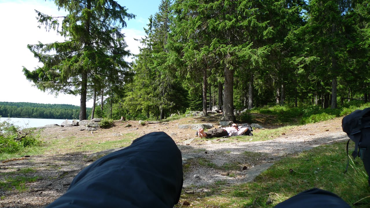
Our first lunch stop on the trip was Øyungen, a very popular area to camp. We had what was to be the longest lunch break of the trip, which included a nice little nap. Having started super early it was no problem lounging in the sun for a while.


Our trek continued along trail which was almost drowned by different flowers and
plants taking the space they saw fit.


It was really hot, and our packs weighed the most they would ever do on the trip, so we took short breaks frequently and made sure to stay hydrated. Since we didn't see any signs of livestock we drank from some streams and used aquamira on the water we got from lakes and such.


According to the route I had set up we should've camped close to the huts "Tømtehyttene", but we both felt great and it was still early in the day, so we carried on along the trail towards Hakadal, a trail I've walked several times before with other friends.


Close to the spot we'd chosen as a camp site we met a man walking along with his bike. This puzzled us a bit since the conditions weren't exactly suitable for mountain biking there, and that wasn't a mountain bike. Anyway we chatted a bit and during the conversation I asked him about water sources, if it was safe to drink from streams and lakes in Nordmarka without treating the water. According to him he had never had any issues with that, having been active up there a lot and drinking everywhere (but being cautious when seeing cattle and sheep). Still, we opted to treat whenever we were in doubt, and we never had any issues from the water during the entire trip.

Our first campsite, the highest point along the trail between Øyungen and Hakadal, proved to be less than ideal. It was open and airy with a nearby pond as a water supply, but with only moss covering the rock surfaces there, making it impossible to get the pegs in, we had to go into a neabry forest to find a suitable spot to pitch our shelters. As we went about doing that we got introduced to our new, most irritating friends, the mosquitoes and noseeums. I was glad to have brought my headnet because it came to good use. That combined with a windshirt and long pant helped keep them at bay. As we made dinner we felt rain was in the air, and true enough we got hit by some drops soon after. Dinner was a low tone affair as we were both tired and annoyed by the bugs, especially Joe I think :).

Joe having a great time getting to know his new buzzing trail companions.


The next day we moved on to Hakadal, a village down in a valley. When we arrived there I asked some people if there was a store there (hiker hunger already appearing), and sure enough there was supposed to be, plus a 7-eleven, one some kilometres from where our next leg started. Both of us immediately started vocalizing a desire for the national dish of Norway, hot dogs with all the condiments added, as well as some kind of sports drink. We never found the 7-eleven, but the store was nice with kind people who even said hello (never happens in Oslo) and let us refill our water bottles in the back room. This was when we started to discuss the possibility of hiking this trail and grocery shop along the way instead of carrying food for a week, like we both did at the time. Joe was of the impression that it could be doable, but that it probably wouldn't mean that we would save so much weight, more that we would be able to eat better food.

After backtracking to the trail we started one of the toughest climbs of the trip, for me anyway, carrying a full pack, 2 litres of water and some food from the store I hadn't be able to finish eating. The trail then flattened out and after a while we arrived at the lake Stor Øyungen where we had a nice lunch, cooling our feet in the water and watching a family some hundred metres away closing up the hut and going home, probably after having had a great weekend. Had a great conversation with Joe here, slowly starting to get used to having to speak english all the time (at the end of the trip I was actually thinking in english).

We headed northwards, through bog, on trail and on forest roads, very varied hiking which would become typical of the days ahead.

About to hit the bog.


Feeling good we decided to aim to stay the night at the hut "Råbjørnhytta" where I've stayed before with Glenn and other friends of mine. It's a great spot with a lake close by, a rowing boat available for guests and more. Hiking there was swift and enjoyable as we got into a mile crunching pace.


A woman and her two kids were there already and they were quite amazed to hear what we were up to, having themselves just returned (by car) from Jotunheimen were they had been on top of Fanaråken. First order of business was to get all our gear out and dry stuff etc., and then have some dinner.


I slept well that night except for my sleeping bag being super warm for the conditions at this point and for a single fly that was driving me crazy. As soon as I was about to fall asleep it would buzz close to my ear and bring me back to consciousness. After a while it flew up to Joe in the top bunk and I could hear him being annoyed, but still asleep.

Breakfast was real nice in the cozy kitchen there.


An hour hike from Råbjørnhytta we hit Snellingen where they were doing maintenance work on the hut and therefore making it inhabitable. We did however get some great, ice cold, water from the well and had a nice lunch on the hill, surrounded by sheep constantly signalling to each other about their whereabouts, and being curious about us human intruders. Some approached to get food, but we didn't give them any, wanting some peace and quiet while eating :).

We tried to write "wish it was beer" on this :):


Our next leg took us to the best camp of the trip, at Avalsjøen. A long the way we again experienced very varied trail conditions, from calf deep mud and sheep poo mix, to clear streams and smooth grass. We managed to put one of our infamous backtracks into the mix too after not trusting that not seeing blue markings is a bad omen (we would repeat this several times, trust me, before learning from our mistakes).

Smoooooth trail


It was amazing to arrive at the *small* peninsula at Avalsjøen in nice weather, with a breeze keeping the bugs away, and the possibility of taking a swim to rinse away the sweat and dirt from the hiking day that had been. I quickly took advantage of that and felt super refreshed. Our yellow shelters looked great, giving us a feeling of being the hobo circus just having arrived to town. After dinner and having everything hung up to dry, we retired to our yellow MLD homes and caught some much needed sleep.

Nice to relax in the nice weather having set camp and all chores done.

Joe's Duomid in the front, my Trailstar in the background.

I'm teaching Joe how to set up a super tight clothes line.


The next day was one of the toughest of the trip, trying to get to Lygna where we could rent a cabin for the night. Turned out to be 30 km hike on wet trail with sheep poo, bog, but also some real nice trails, especially along the lake Vassbråa.

Starting to look the part :)

Really nice hiking along the Vassbråa lake.


We stopped at the hut there to have a peak inside and it looked really cozy. The water from the well (with one of those old mechanical pumps) was some of the best I've ever drunk in Norway, almost articifal looking. Incredible.

Fantastic water!


After a lunch stop and rehydrated on the "super water" we did some serious mile crunching, powering up a long the road to the trail head in record time, and then climbing a hill in stride, both feeling very strong and energized. After crossing the hill however, and being hit by bog after bog, our spirits sunk quite a bit. That last section to Lygna seemed to last forever. I think Joe was having a tough time here and I went in front as I still had some strength left (this is something we did naturally during the trip, taking the lead when we felt the other person needed support).

This might be a good time to say something about the dynamics between me and Joe on the trail. What I really liked was that we helped and supported each other all the way. Like for instance the time when I lent my aquamira to Joe and he returned it also having treated my water, helping each other with washing hands before meals, or just small things like picking up each other's hiking poles. Small things like that means a lot. I also liked that we didn't have to talk all the time. We had our periods during the day where we would talk a lot about gear and life in general, but then we might be quiet for a while as we concentrated on getting some hiking done and getting to where we wanted to be. On the other hand I noticed being affected moodwise the few times Joe wasn't feeling well, which is to be suspected when being such a close-knit team, and being friends that care about how the other person is feeling. Of course it worked the other way too, Joe lifting my spirits several times. Just something to observe. It was quite a different experience hiking alone, which I'll tell more about later in my next post.

Anyway, we made it to Lygna, rented a cabin, bought hot dogs and cheese doodles and chilled out after the chores were done.


We got soft beds with smooth linen so I slept like a baby, looking forward to meeting my friend Leif the next day to hike with us in the area where he grew up.

After breakfast Leif arrived and we hit the trail again in nice weather, even though yr.no had forecasted overcast, go figure.


Our campsite for the night turned out to be a spot to the west of the pond "Hauktjernet". To get there we had to traverse a lot of high grass first, because I stupidly suggested we go that way, until Joe figured out that some kind of service road had to exist since we could see a hut close to where we wanted to camp. Soon after we arrived it started to drizzle, so I assisted Leif in setting up his enormous 4 by 3 meter Helsport tarp.


One of the highlights of the trip for me, seeing Leif enjoy himself.


That was a welcome place to hang around, chatting and eating dinner, even though the bugs were fierce!.

Leif had a superior bug net.


Slept ok that night, but woke up to a wet camp. All in all a miserable camping experience, even though we had some laughs and good conversations under that giant tarp :).


The next day we ate a healthy dose of GORP and climbed the hill "Kvitingen", followed by a ridge traverse in bog, bog and bog. This turned out to be one of the toughest days on the trip, espcially for Joe I think which I could sense was real fed up with bug traversing and generally tired. Leif wasn't feeling that well either.


After getting through all that bog we contacted Leif's father who came and picked him up, bringing him home to a cleansing shower and other good things in life. Joe and me looked for a suitable spot to set camp and found another miserable one with masses of noseeums. We had a quick dinner and retired to our shelters to catch some sleep.

At about 3 am i awoke to rain hitting my trailstar hard, and a puddle at the end of my inner. Turns out that one of the corners of the inner was slightly outside the tarp so rain had been able to get to it. The bottom of my (down) sleeping bag was wet, as well as my sleeping pad. I spent a couple of minutes thinking things through (wasn't exactly thinking clearly or quickly at 3 am), and then excited the inner, put on my wet clothes and proceeded to fix things. Got some sleep afterwards, but miserable camping experience noentheless :).

What a wonderful morning!. At least I was inside my belowed bug free inner.


The next morning we decided to leave camp as soon as possible and to have breakfast somewhere else with fewer bugs(!).


Oatmeal with dehydrated apple slices, almonds, linseeds, milk (powder)
and hazelnuts. This stuff supplied lots of energy for the morning to come!


Our next leg was to Vesterås where there was supposed to be a cafe of sorts and a parking lot. We reckoned we would find a nice, level spot to camp there. At this point we really felt we were moving onto higher ground, seeing mountains in the distance and some great views of the valleys.

This lean-to was supposed to be our shelter.


What was about to happen next was the biggest slice of trail magic I've ever experienced. When we arrived at Vesterås we found it deserted, reduced to a large field where horses were grazing. They were curious about us and approached cautiously, allowing us to pet them, but also eyeing and smelling the trail snacks in our pockets. We left them and walked down the road to find a suitable spot to pitch.

I asked Joe if it he thought it would be "awfully rude" to ask someone to pitch on their lawn. He didn't think so, so I proceeded to knock on the door of the nearest house (which turned out to be a hut actually). A smiling, old lady said hello and told us that we were welcome to pitch in the garden, "but isn't it wet there and don't you want to stay in the small hut in the garden instead?" (a hexagonal hut with a fireplace inside, complete with benches with furs on them). We were so happy to finally get to pitch our shelters on flat ground (super flat!), and modest, that we said pitching our shelters on grass was fine, but that we'd love to eat in there because of the bugs. After pitching our shelters so perfect and taught that they looked like something out of a catalog, we went inside the hut. The woman soon arrived again, carrying birchwood to make a fire. She asked if we wanted to make a fire to warm ourselves and too cook on, and if she should do it for us? We accepted and were soon blissfully watching hiker television #1, the best channel by far.


Hiker televison, channel 1


The next morning while packing down, the nice woman approached me and asked if we wanted to have breakfast with her. We accepted and were treated to a really nice breakfast with meatballs, cheese, juice, grapes, coffee and more, all the while having a nice conversation about her family and the hut. When we were about to leave she told us that she could drive us to the store the coming wednesday if we wanted too, an extremely kind gesture, but we politely declined as we had food enough and would soon be resupplied. Her kindness didn't end there; she also gave us a huge piece of chocolate with raisins and nuts to enjoy during the day. What a woman! I got her address so we'll send her something to express our thanks.

This was the day we were to arrive at the B&B, and it wasn't a long one either, so we were both in good spirits. It rained some, but the sun found its way through the cloud cover at times.

 
The last section was along a tarmac road and it didn't take us long to find the B&B. The woman who met us was very nice and showed us the room, kitchen and the other facilities available.


Half of the trail was now done and we looked forward to a full zero day the next day, but also to the next section which would take us higher up, closer and closer to the mighty mountains of Jotunheimen.

More about the last section in a week or so when I get back from a hike on Hardangervidda. I had planned to write it all in this post, but this is getting way out of hand lengthwise :).

Hope you liked it. Feel free to comment. I will as I mentioned earlier write some posts later about gear, lessons learned and one with useful information about the trail itself.

Take care, and be sure to tell your loved ones that you love them. The recent events here in Norway have reminded us that we can't express our love and affection to each other often enough.

Love you Leif, Joe, Hendrik, Helen and the rest of you awesome people in the UL community.